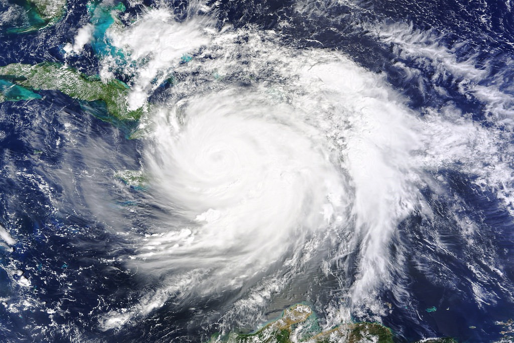
Hurricanes are becoming stronger; sea levels are rising and the damage they cause is catastrophic. In recent years Katrina, Sandy, and most recently Matthew have caused billions of dollars in damage to the US coastline. Meteorologists have realized that the potential storm surge does not account for the wave action accompanying the storm. This marine submersion causes severe and rapid coastal flooding. As the storm increases in intensity there is a rise in sea level due to three main factors. The swell or waves increase the water level, the wind exerts friction on the water and helps to accumulate waves as it nears the coast, and the air pressure is reduced just as the sea level is rising.
A system under development is called the Hurricane Deadly Waves Tracker System (H.D.W.T.S.). The heart of the system is an underwater drone with an ultrasonic wave measurement device. The drone meets the eye of the storm before it gets to the coast. It can send data on temperature, pressure, salinity, and wind speeds to a satellite. Meteorologists can get a horizontal profile of wave action instead of relying solely on images from above the storm.
Each storm will be assigned a coastal alarm line centered on its speed. The evacuation alarm is triggered based on the profile of the wave action. The ultrasonic wave measurement system captures wave amplitude, period, speed, and direction and calculates the horizontal profile to determine the level of sea rise expected. This system can assure a timely retreat of coastal areas that would be impacted by these super storms.

Leave A Comment